THE OLD MATYPOLLIAM ROAD
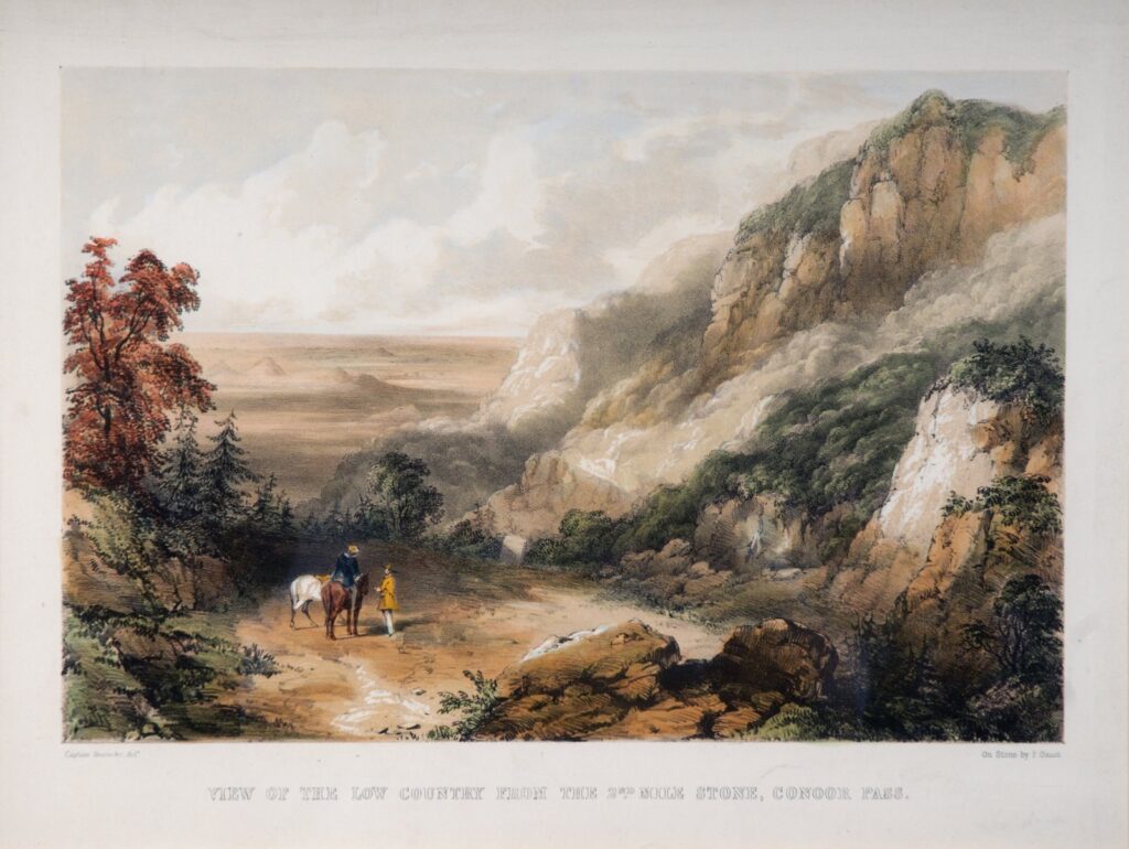
Prior to the opening of the Coonoor Pass by S. R. Lushington in 1832, journey to the summer retreat of Ootacamund was an arduous one. Travellers had to first make their way to Kotagiri, using the circuitous First Mettupalayam Road, and thence proceed onwards to Ooty.
The Old Mettupalayam Road also known as Old Coonoor Ghat was traced by Lt. LeHardy and laid down by a detachment of the ‘Pioneers’ under his and Captain Murray’s command. This considerably shortened the distance, and was as well directly responsible for the growth of Coonoor, from an outlying hamlet of Jagathalla, to that of a station and thence a municipality.
The old road cuts across the present road at nine different points, and is shorter by nearly around 10 kms, but its main drawback was the gradient, being steepest at the top, needing as many as eight pairs of oxen assisted by three men to pull a cartload up.
Starting at Mettupalayam, the Bhavani River had to be crossed by coracles before it was bridged with an arched masonry structure in 1840, and after Kallar, the ascent began bypassing many of the present day hairpin bends and the Coonoor River. Parts of this old road still remain as the shortcut between KNR and Marapalam, and as the path leading from the Horticultural Station a little above the latter, to Coonoor, through the Tiger Rock Estate now known as Iboo Sait’s Estate and Kannimariyamman Kovil, the steepest stretch.
Firsthand information about travel along this road can be learned from Sir. Richard F. Burton’s, ‘Goa, and the Blue Mountains,’ where he recounts his journey made in 1847. Unfortunately this ‘Haji’ who had seldom anything good to say about almost anything, landed up at Mettupalayam when heavy rains in the hills had washed away the masonry bridge over the Bhavani River, and most of the placid mountain streams were raging torrents.
Nevertheless Burton and his party set out with their journey on horseback, leaving their heavy luggage to come behind them after the Bhavani was fordable to bullock carts. Burton describes the road as parapetless and worn down to bare rock at places, with the pathway liberally besprinkled with earth, stones, and trees, which had slipped down from the lee side. The stream that now flows under the present Burliyar bridge appears to have been nigh uncrossable, and was forded only after some whipping and spurring of the mounts. He also describes the ‘Burliyar Bungalow’ as a sort of midway point, and in the same depreciatory vein, but is more charitable where the climate and the scenery are concerned.
Dr Baikie in his ‘Neilgherries’ is much more kinder, and though he comments adversely upon the steepness, states that the road is 15 feet wide, the scenery both sublime and grandiose, and a new improved road, the present ghat, was in the offing which was expected to be 20 feet in width and conducive to transit carriages.
Yet another decade and a half had to pass before the road that Dr Baikie alludes to, was made open to the public in 1871, the present Coonoor-Mettupalayam Road, traced and mainly laid by the then Lieutenant and later Colonel G. V. Law, with many a zigzag to ease up the gradient, and a wooden bridge over the Coonoor River to circumvent the steepest stretch.
His name is forever commemorated by the cascade called the ‘Law’s Fall,’ on the lower part of the Coonoor River, just above the bridge named in honour of Lord Wenlock, by which his road crosses that stream.